Wilsons Promontory - Southern Circuit hike and visit to South Point

It was the week before the Easter in April and I was sitting in my car on the way south to Wilsons Promontory. Yes, it was time to get out again. I had booked 3 nights in different campsites - Oberon Bay, Little Waterloo Bay and Roaring Meg - and was really looking forward to this short trip. I love Wilsons Prom – it strongly reminds me of my first year living in Australia when I went there on the recommendation of a good friend back in Germany, who had visited in the early 90s. I experienced it first in late ’99 and have come back regularly since.
After driving from Melbourne for a few hours, with a short coffee stop in Leongatha, I arrived at Tidal River around lunchtime. I checked in with the Ranger, parked in the ‘overnight hiker carpark’ and took the shuttle bus up Mt Oberon to my starting point.
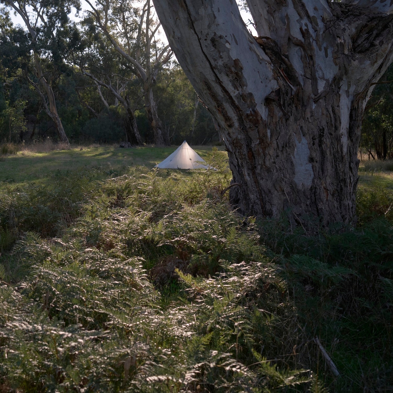
I set out on the central (north-south) gravel road that functions as the service road for the lighthouse; both coastal trails had been partially destroyed by the 2021 storms so were not accessible. After a few kilometres I took the turn-off westwards towards Oberon Bay. There were not many people when I arrived there, and I found a really nice camp spot. I soaked my dinner and pottered around with the new shelter I’d built. I had set it up a few times at home but was curious to see how things would work out here (it was fine!).

 I took dinner down to the beach and watched the sunset - it was cold-ish but the light was stunning. Then it was time for bed. If possible, I like to leave the tent open so I have a view, and there is much less problem with condensation. I love falling asleep lying on my back and looking up at the stars. Although… to be able to see the stars I have to wear my glasses, which means I fall asleep with them, which can cause them to break, which would not be ideal while out.


What a night - I slept like a baby. I think it rained lightly overnight but not much. I got up, made breakfast, packed up, used the local long drop, filtered some water and headed off late in the morning. I had a short day of walking to get to Little Waterloo Bay, one of my favourites. Stopped a few times on the way for water, to eat, and take photos.

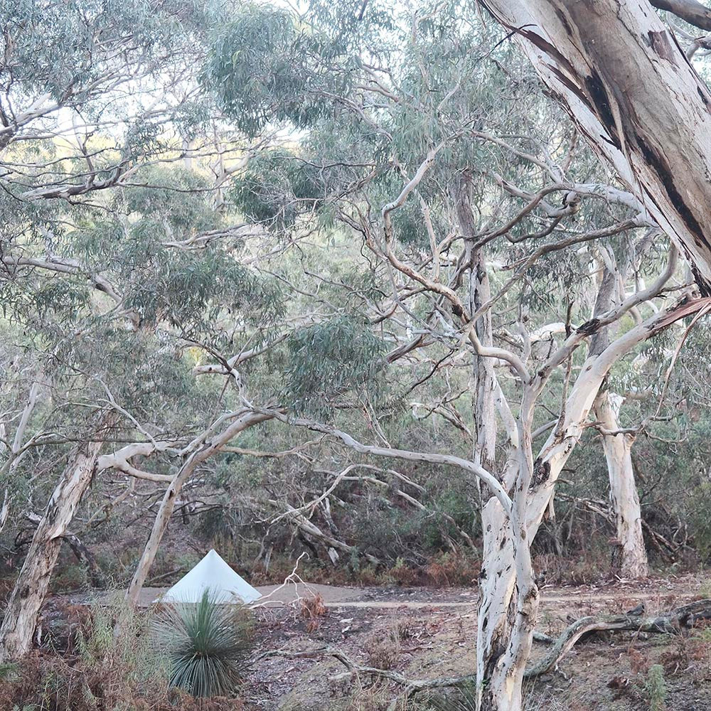
On arrival at Little Waterloo Bay there was only one other tent in the campground. I chose a spot that I had used previously, near a platform which is ideal for sitting, stretching and preparing food. It was very close to the beach and I knew it would be damp overnight so used a ground cloth under the inner of my shelter, avoiding all that mud and sand sticking to it in the morning. After setting up I went to the beach and sat down with a tea. It is a beautiful place. In the past there had been discussion of building a resort here - wow, we’re lucky it never came into being. I strolled up and down the beach to take some photos, then took off my shoes and walked through the water.


 While at the beach I saw a few other hikers arriving. By evening there were around 7 groups of hikers spread out in the campground. I had no direct neighbours and enjoyed a quiet afternoon. Back to the beach for another stroll in the evening. My sleep was fantastic - could hear the waves breaking during the night.
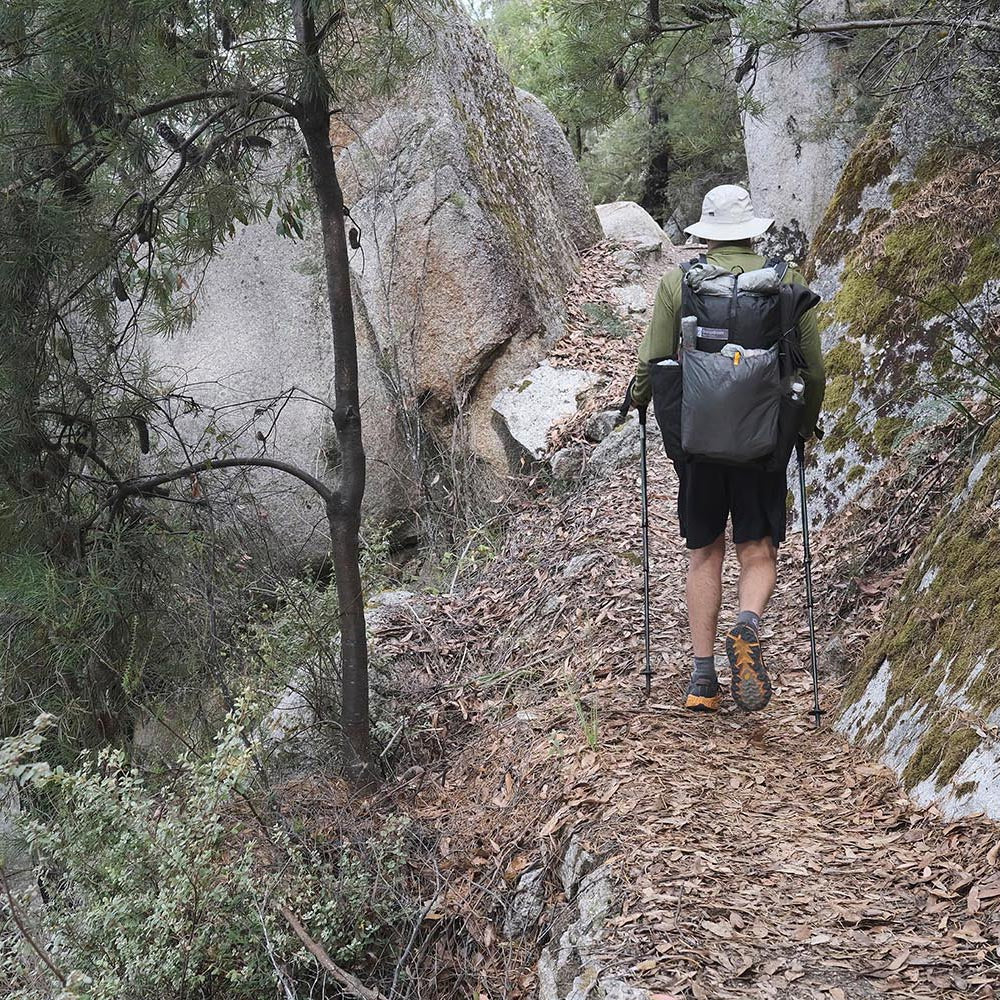
Early next morning I woke up and started getting ready. I definitely wasn’t in a routine yet and it took ages to pack everything up. I seem to ‘unlearn’ my packing routine after I get home and have to start from scratch every time I hit the trail again - do you too? Finally got going, and walking along Waterloo Bay in the sunshine was bliss. I knew there were water sources along the way so I didn’t need to carry much water. The hike along this stretch of coast was glorious, as always. But first I had to get off the beach and up the hill, which seemed to stretch out for a while. Once up there it is fantastic walking through coastal shrubbery, which opens up every now and again at big boulders to offer views of the ocean and down into the forest.

A bit further on you can see the headland where the lighthouse sits.
There is a spot on this section which I recognise as I approach it and which always makes me feel a bit uneasy. On one of my previous trips I had had to jump backwards when I saw a snake late, with only 3-4m distance between us. It’s one of those dark, damp corners with a small creek running down the hill and ferns growing densely over the path. The snake had been lying on the trail trying to soak up some warmth from the sun, which was shining unevenly through the ferns providing excellent camouflage. Luckily the last two times I’ve had free passage – phhhew.

On the southern part of the peninsula I took a longer break, enjoying the view to the lighthouse. I decided not to take the detour to the lighthouse as I had visited it not long before, and had to watch the time. The hike from the lighthouse to Roaring Meg follows the coastline, crosses the lighthouse service road and then goes straight over the hills to the campground. The last few kilometres are a real up and down rollercoaster, which my legs would confirm later! I wanted to reach Roaring Meg early-ish as I had planned to hike to Australia’s southernmost point (on the mainland) after setting up camp.
While setting up at Roaring Meg I had something to eat and met the neighbours, a father and son duo from Gippsland who were out for a few days. They had been staying at the lighthouse but were also camping along the way. They enjoyed themselves and I bet have created some great memories.
During the afternoon I walked down to the south point with my nearly empty pack and camera. When I got there I realised my memory of this spot had blurred in the 21 years since my last visit, which was mid-winter 2001 on my second visit to the Prom. At that time it was real winter weather, but now in mid-April it was mild with barely any wind. I sat down on one of the rock ledges and contemplated this amazing place. After soaking up the views, the noises and smells for a while, I got up and wandered around to take some photos.


 The sun was setting and with the changing light the landscape changed as well. Before long the sun had moved behind the horizon and it was time to head back. While walking uphill away from the coast I kept stopping and turning around to take in as much as I could of this special place.

By the time I got back to Roaring Meg it was pretty dark and I needed my head torch while the moon was trying to show me the way.

It was dinner time, and while preparing for the night the neighbours and I sat together for another good conversation. We chatted about gear, environmental issues, photography and life in general - thanks guys, it was a pleasure meeting you.
Again I slept like a baby through the night. The next morning I packed up and walked back to my car. It was an uneventful but very enjoyable walk back. Nothing to report about the drive home.
Perfect trip. Loved it!

All images copyright by Thomas, OrangeBrown.
No copying or use of images without written permission.
1 Response
Leave a comment
Comments will be approved before showing up.
Also in News

The Heysen Trail section hike NOBO 2022 - Part 2
After leaving Victor Harbor and the coastline I was wondering what to expect next as I turned northward and headed inland. Over the previous few days I had experienced the landscape along the southern coast of the Fleurieu Peninsula and loved it - would I enjoy the next section too?

The Heysen Trail section hike NOBO 2022 - Part 1

Jacob
November 14, 2022
I’ve just recently done the circuit and closed my endeavor to visit Australia’s Centre (Median, not Lamberts tho) & cardinal points and the highest and lowest points in altitude.
Recent heavy rains and spring time made the landscape colorful and lush and of cause brought plenty of frogs and leeches. Luckily the rain on day one made the mozzies stay away.
It was the long weekend over the Melbourne Cup which I didn’t have on my radar and so there was only Friday night not fully booked out. I’ve been still waiting for my new tent from Durston and so only brought a ultralight tarp—which in the end turned out really well as I could easily collect rainwater and purify it with my Grayl bottle.
I booked into the roaring Meg campsite and left it open for the next day if I wanted to do the circuit or just the south point and lighthouse. Through a land slip on the road up to the Telegraph Saddle I had to take the Bus and left after lunch. That left me doing the south point early next morning instead of on the same day. Anyway I decided to go for the whole circuit on the 2nd day plus the 4km down to Tidal River after sunset as I was too late to take the bus.
But despite the rain on the 1st and the huge distance on the 2nd day (nearly 36.6km) I thoroughly enjoyed the trip through the lush vegetation, spring flowers and frog calls.